
Studying biodiversity from satellite
Reading time
0 min
Used until now only for soil study, today the satellite is also a valuable ally for marine biodiversity analysis
In spy films, satellites are often used to uncover illicit trafficking and monitor the movements of enemy agents. In reality they can serve something monto different but equally fascinating: monitoring the health of marine biodiversity. Marzia Cianflone, a molecular biologist, does just that.
“I had never tackled the marine environment before,” she declares, “but I needed to challenge myself and I didn’t want to be monotonous in my course of study.”
A second-year Ph.D. student in biology at Professor Simonetta Fraschetti’s Marine Ecology Laboratory at the Federico II University of Naples, he is currently involved in research conducted by NBFC within the laboratory. “The points of contact are many,” he explains, “and the synergies seem to us to be winning.”
Protagonists of the interview
Marzia
Cianflone
- Molecular Biologist
- University of Naples Federico II – Italian Aerospace Research Center
- marzia.cianflone@unina.it Copia indirizzo email
Living (many) underwater
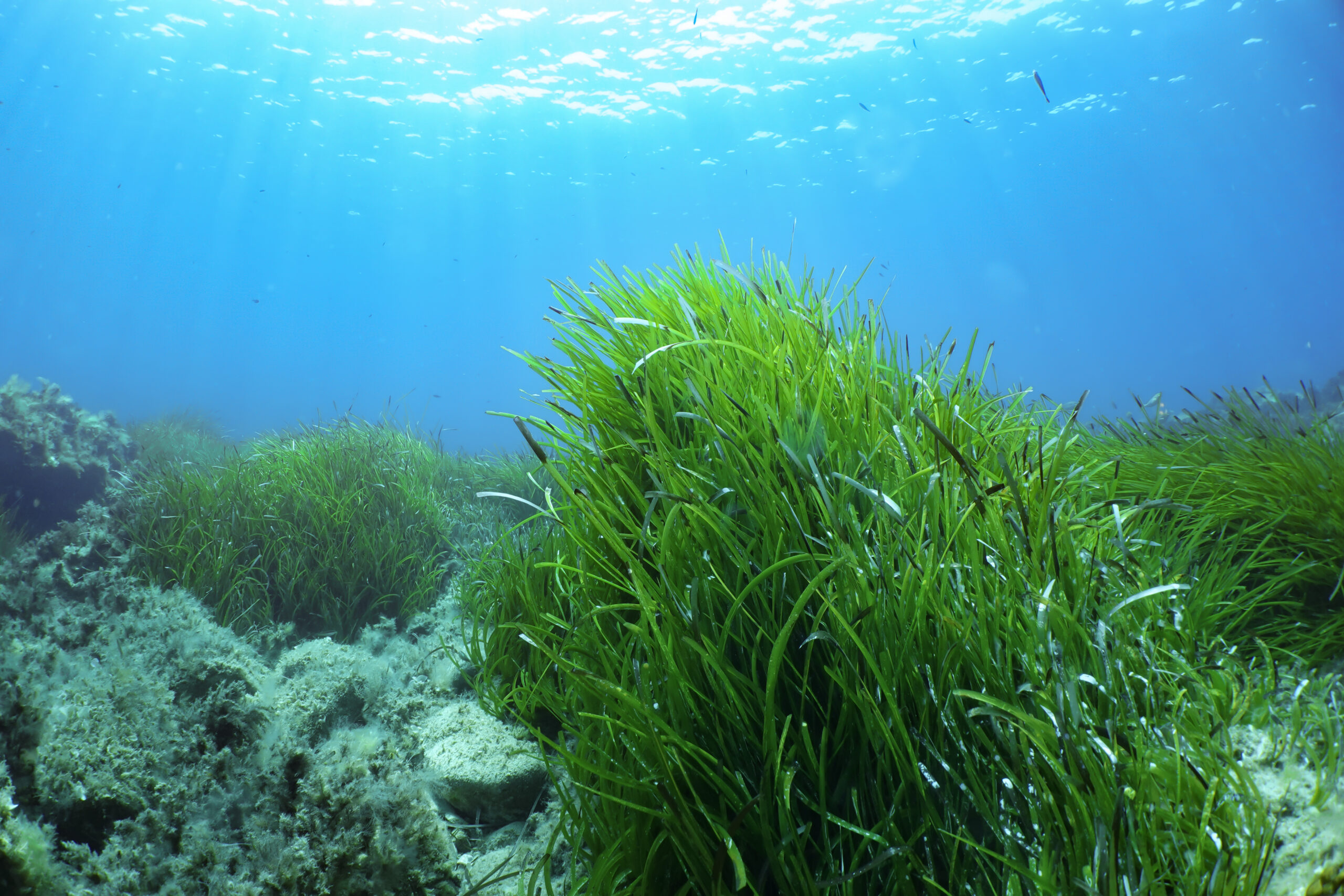
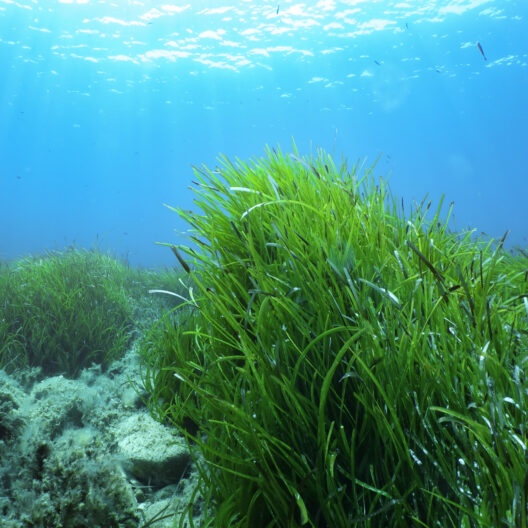
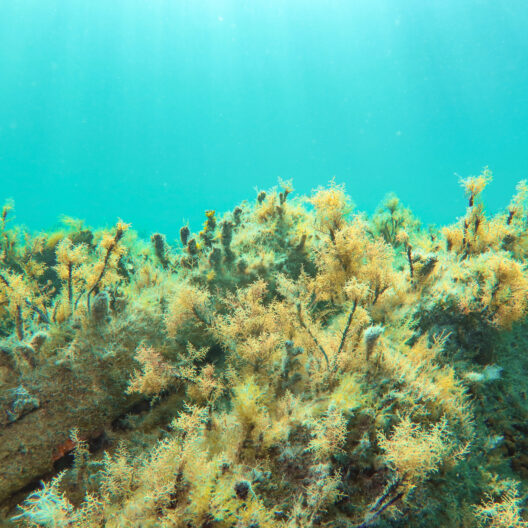
Cianflone’s doctoral project deals with monitoring and mapping various coastal marine habitats by satellite. Seagrasses and aquatic plants are among his interests.
“Le seagrasses“, Cianflone explains, “are aquatic plants that have evolved differently from seagrasses: they are in fact derived from terrestrial plants. They are the only flowering plants (phanerogams) that have adapted to live in marine environments. They include Zostera maria, Cymodocea nodosa and Posidonia oceanica, the latter being particularly important to us because it is endemic to the Mediterranean Sea.”
“The marine habitats that are the subject of our research,” Cianflone continues, “provide an ideal environment for many organisms and are an important indicator of biodiversity. The two are linked: if habitats are healthy, their biodiversity is thriving and flourishing.”
Both seagrasses and macroalgae play important ecological roles and support an ecosystem rich in biodiversity. Indeed, they act as nurseries, providing shelter and food, and are habitats for many species of benthic (i.e., living on the seafloor; these include fish, cephalopods, and crustaceans) animals.
An unexpected link between satellite and sea
To monitor the health of these marine environments, Cianflone enlists the help of satellites, which have been widely used, over the past 30 years, for environmental ecological purposes that mainly involve soil. “We pay attention to water, where we have to find solutions to immediate problems: among them, the first one is that the water column imaged by the satellite acts as a filter and prevents a clear view of what is on the sea floor.”
But solutions exist.
“The European Copernicus project,” Cianflone continues, “has a section dedicated to the sea, Copernicus Marine Service. Through it you can consult free data on biological variables such as chlorophyll concentration, which indicates the presence of vegetation, or chemical-physical variables such as salinity, temperature and pH of the sea.”
Another valuable source is Planetscope, “a constellation of more than 430 U.S. satellites that, as part of its Education and Research program, provides free images to undergraduate and doctoral students.”
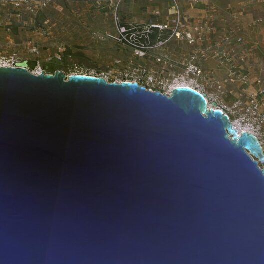
Cianflone’s work, which focuses on the marine protected areas of Porto Cesareo and Torre Guaceto, starts by viewing satellite images available on the website of the chosen provider. Once he identifies the most interesting ones, he sorts them in high resolution for analysis.
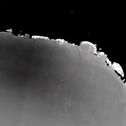
Not all have the same utility for current research. “Satellites are equipped with a variety of sensing devices, particularly optical cameras, called multispectral cameras, which can capture images in numerous light frequency bands,” the researcher explains.
“In the analysis of solar radiation scattered by marine vegetation, the green band is very important for our research. Unfortunately, we are not as fortunate as our colleagues working on land, who can make ample use of the stronger near-infrared response, which is instead almost completely shielded by water surfaces.”
Images to be processed
Once the images have been acquired, radiometric correction algorithms are applied to them to compensate for the filtering effect of the water column, which absorbs much of the solar radiation.
With Luca Cicala, an engineer and Cianflone’s mentor at CIRA, the Italian Aerospace Research Center collaborating on the project, “we aim to develop artificial intelligence technologies capable of identifying and classifying, with a high level of automation, coastal marine habitats consisting of expanses of vegetation.”
Among the advantages of satellite observation, Cianflone points out both the possibility of capturing alarge area (about 400 sq. km the one examined in his research) and the possibility of monitoring the same area continuously and over the long term: by studying past images, it is therefore possible to understand whether marine habitats are stable or negatively affected by anthropogenic impacts and climate).
The analyses carried out using satellites, although of great use, do not exhaust the data collection activities that marine biologists must undertake to characterize coastal habitats.
The results of automatic processing performed on satellite images, in fact are periodically confirmed by “sea truths” in order to obtain a more detailed interpretation of the observed phenomena. These on-site verifications, even if only photographic, are necessary to substantiate the actual correspondence of what is observed at a great distance from the satellite with what is actually present below the sea surface on the basis of direct feedback. Therefore, although technological tools are available today to observe the sea from space, it is still necessary to continue to … “get your hands wet.”
I decided to study biology because ever since I was a child I wanted to understand what underlies life. I believe that studying the laws and relationships that govern the world makes us more aware of ourselves, our surroundings and the impact of our actions on the planet’s ecosystems. I am proud to make my contribution to the protection of biodiversity.
Marzia Cianflone, PhD Student, University of Naples Federico II